
In order to speed loading, this page has now been split into multiple pages.
According to my counters, there have been:
HURRICANE AND TROPICAL STORM INFORMATION

| CATEGORY | PRESSURE (MB) | CENTRAL WINDS (MPH) | SURGE DAMAGE (FEET) | STORM EXAMPLE AND YEAR |
|---|---|---|---|---|
| 1 MINIMAL |
980+ | 74-95 | 4-5 | JERRY 1989 |
| 2 MODERATE |
965-979 | 96-110 | 6-8 | KATE 1965 |
| 3 EXTENSIVE |
945-964 | 111-130 | 9-12 | ALICIA 1983 |
| 4 EXTREME |
920-944 | 131-155 | 13-18 | CARLA 1961 ANDREW 1992 |
| 5 CATASTROPHIC |
920 | 155+ | 18+ | CAMILLE 1969 |
Effects
From the US Navy (large file)
This is an Adobe PDF file, and requires the
FREE Acrobat reader from ADOBE
This shows storms from the African coast to the Gulf of Mexico
Category F0: Light Damage (<73 mph); Some damage to chimneys; branches broken off trees; shallow-rooted trees pushed over; sign boards damaged.
Category F1: Moderate Damage (73-112 mph); Peels surface off roofs; mobile homes pushed off foundations or overturned; moving autos blown off road.
Category F2: Considerable Damage (113-157 mph); Roofs torn off frame houses; mobile homes demolished; boxcars overturned; large trees snapped or uprooted; light-object missiles generated; cars lifted off ground.
Category F3: Severe Damage (158- 206 mph); Roofs and some walls torn off well-constructed houses, trains overturned; most trees in forest uprooted; heavy cars lifted off ground and thrown.
Category F4: Devastating Damage (207- 260 mph); Well-constructed houses leveled; structure with weak foundations blown off some distance; cars thrown and large missiles generated.
Category F5: Incredible Damage (261- 318 mph); Strong frame houses lifted off foundations and swept away; automobile sized missiles fly through the air in excess of 100 meters (109 yards); trees debarked; incredible phenomena will occur.
IMPORTANT NOTE ABOUT F-SCALE WINDS: Do not use F-scale winds literally. These wind speed numbers are estimates and have never been scientifically verified. Different wind speeds may cause similar-looking damage from place to place�even from building to building. Without a thorough engineering analysis of tornado damage in any event, the actual wind speeds needed to cause that damage are unknown.
TORNADO INFORMATION
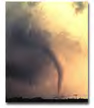
Fujita Tornado Damage Scale:
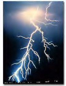
THUNDERSTORMS AND LIGHTNING
RETURN TO TABLE OF CONTENTS
MARINE WEATHER
INCLUDING GALVESTON AND MATAGORDA BAYS
RETURN TO TABLE OF CONTENTS
FIRE WEATHER

Click on image above for more information
VERY comprehensive, includes fire maps, statements, wind conditions, etc.
- Interactive Fire maps for WESTERN states. Remote Automatic Weather Stations
RETURN TO TABLE OF CONTENTS
OTHER WEATHER RESOURCES
TEXAS, NATIONAL, WORLDWIDE
from the University of Michigan
from Storm Chaser Home Page and WSI
Calculate Wind Chill, Heat Index and other weather numbers
RETURN TO TABLE OF CONTENTS
WEATHER EDUCATION
Preschool/Early Elem.
K-12 and College
from UIUC - information on many weather topics for high school and college students.
Sea-viewing Wide Field-of-view Sensor (SeaWiFS) Project
RETURN TO TABLE OF CONTENTS
HISTORICAL WEATHER
RETURN TO TABLE OF CONTENTS
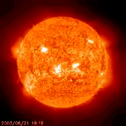
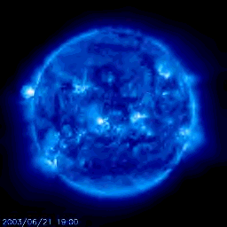
SPACE WEATHER
Space weather effects our communications, TV, cell phones, pagers, satellites, power grids, and a host of other electro-magnetic devices.
NOAA SPACE AND SOLAR WEATHER PAGE
Detailed space and solar weather resourcesRETURN TO TABLE OF CONTENTS

RETURN TO TABLE OF CONTENTS

DOWNLOAD THE LATEST VERSIONS OF INTERNET
AND OTHER SOFTWARE
RETURN TO TABLE OF CONTENTS
DOWNLOAD THE LATEST VERSIONS OF ANTI VIRUS SOFTWARE
RETURN TO TABLE OF CONTENTS
BEAUMONT POLICE DEPARTMENTRETURN TO TABLE OF CONTENTS
This page is maintained by Ira Wilsker iwilsker@ih2000.net.